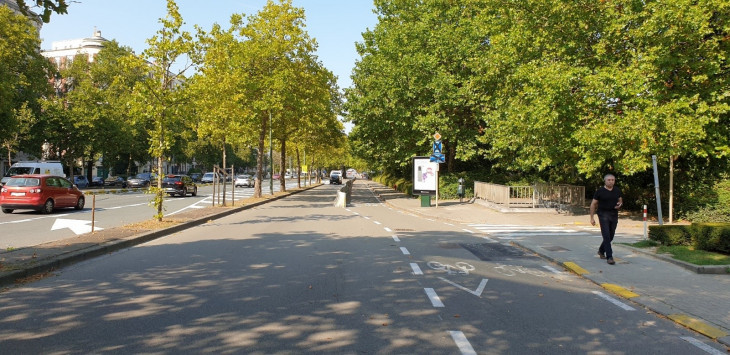
Located in the north-eastern part of the Brussels-Capital Region, the Auguste Reyers Boulevard forms the middle ring road of the capital. It includes the Reyers interchange, which provides a connection between the E40, the boulevard and the Avenue de Cortenbergh.
The project follows the removal of the Reyers viaduct (in 2015) and the renovation of the tunnels (in 2018-2020). It is the concrete expression of the definitive development of this metropolitan axis and its evolution into an "urban boulevard".
The objective of this evolution (transforming the current boulevard into an urban boulevard) is to better take into account active modes of travel (pedestrians, cyclists), to improve road safety and to ensure better integration of the infrastructure into the landscape and the development of quality public spaces.
The project is mainly located on the municipal territory of Schaerbeek, also extending into Woluwe-Saint-Lambert (southern part of Square Vergote only), at the level of the meeting point between the four districts of Plasky, Reyers, Georges Henri and Porte Tervuren. But it excludes the Meiser square.
The documents are available on openpermits.brussels
General project information
Cities
- Schaerbeek
- Woluwe-Saint-Lambert
Contracting authorities
Routes
| Name | Date | More informations |
|---|---|---|
| Enquête publique | Du 9/4/2021 au 9/5/2021 | |
| Commission de concertation | 20/5/2021 |
